


SityTrail - 4202124 - cotentin-j3

chessyca
Gebruiker GUIDE
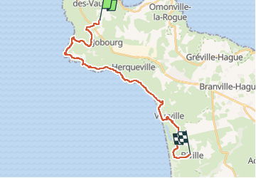

Lengte
23 km

Max. hoogte
131 m

Positief hoogteverschil
737 m
Km-Effort
33 km

Min. hoogte
3 m

Negatief hoogteverschil
705 m
Boucle
Neen
Datum van aanmaak :
2024-10-03 09:44:04.68
Laatste wijziging :
2024-10-03 10:13:51.969
7h30
Moeilijkheid : Moeilijk

Gratisgps-wandelapplicatie
 SityTrail
IGN / Geografische instituten
SityTrail Plus
De wereld gaat voor u open
Over ons
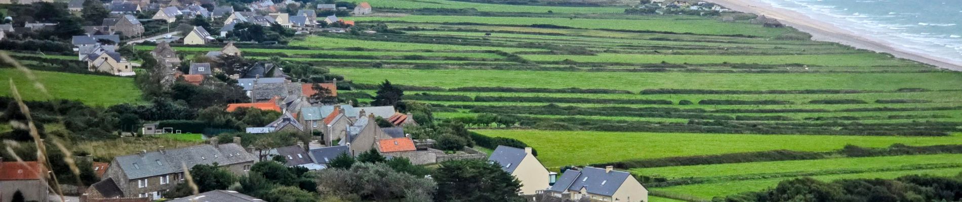
Tocht Te voet van 23 km beschikbaar op Normandië, Manche, La Hague. Deze tocht wordt voorgesteld door chessyca.
Beschrijving
Troisième étape , plus courte mais compensée par le dénivelé
Spectaculaire
Foto's


Plaatsbepaling
Land:
France
Regio :
Normandië
Departement/Provincie :
Manche
Gemeente :
La Hague
Locatie:
Jobourg
Vertrek:(Dec)
Vertrek:(UTM)
578499 ; 5505596 (30U) N.
Opmerkingen